


Updated at: 2022-12-09 03:49:50
It is to locate geographic locations by geographic coordinates. This is implemented by Geohash aggregation, which can group multiple sets of coordinates into a set. The presentation of the world map requires the geo_point field with longitude and latitude coordinates resolved by the IP address. The specific steps are as follows:
1. Click Visualization > World Map to select data sources. You can filter out the required data sources by selecting Log Group or Saved Search;
2. Make world map visualization editing, and configure parameters as follows:
1) Configure the aggregation type of field values:
• Aggregation: Select the aggregation type for the set value: Count (default), Avg, Sum, Median, Min, Max, Unique Count, Top N;
• Conversion of Units: Set the conversion from original units to target units, and you can enable/disable this function;
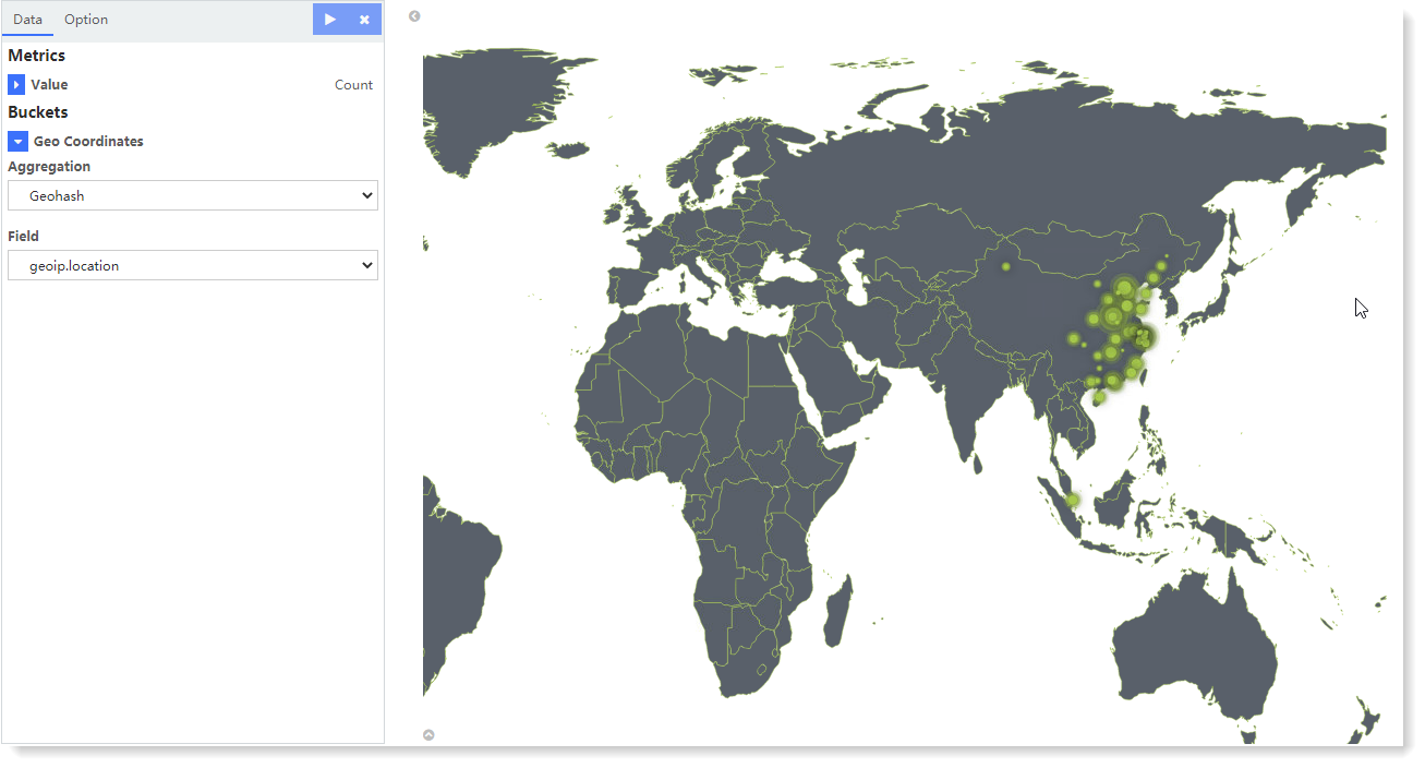
2) Configure location coordinates:
• Aggregation: Geohash by default;
• Field: Bucket aggregation is based on the field geoip.location by default.
3. After completing the above configuration, click the button at the top left to check the visual view on the right, as follows:
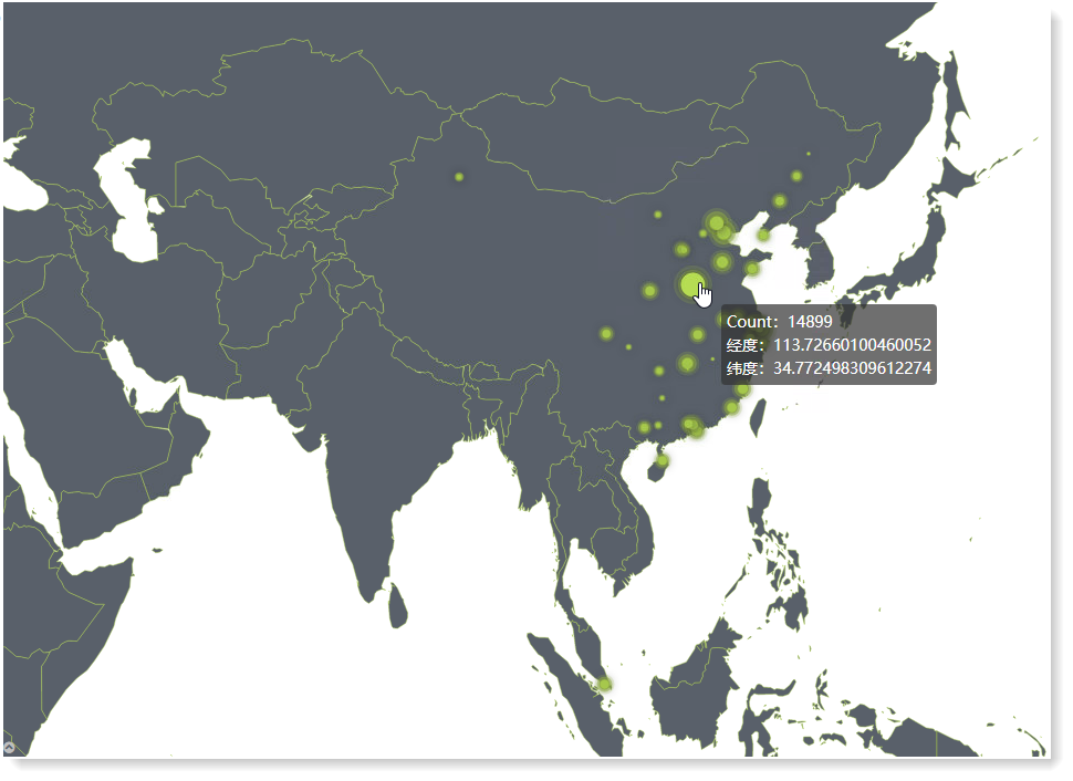
The above example shows the geographic access distribution for a business application. Hover over a data point, and a floating window will display Field Aggregation Value, Longitude and Latitude, as follows:
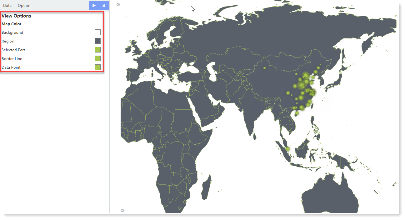
4. For the generated chart, you can also switch to Option and set the Map Color, as follows:
5. Click Save to complete the current visual view creation.
1. Click Visualization > World Map to select data sources. You can filter out the required data sources by selecting Log Group or Saved Search;
2. Make world map visualization editing, and configure parameters as follows:
1) Configure the aggregation type of field values:
• Aggregation: Select the aggregation type for the set value: Count (default), Avg, Sum, Median, Min, Max, Unique Count, Top N;
• Conversion of Units: Set the conversion from original units to target units, and you can enable/disable this function;
2) Configure location coordinates:
• Aggregation: Geohash by default;
• Field: Bucket aggregation is based on the field geoip.location by default.
3. After completing the above configuration, click the
button at the top left to check the visual view on the right, as follows: The above example shows the geographic access distribution for a business application. Hover over a data point, and a floating window will display Field Aggregation Value, Longitude and Latitude, as follows:
4. For the generated chart, you can also switch to Option and set the Map Color, as follows:
5. Click Save to complete the current visual view creation.
< Previous:
Next: >